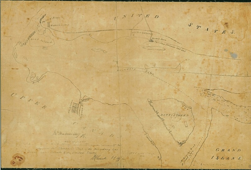
Thompson’s Map of the Boundary line between Upper Canada and the United States, 1838
This map of the boundary line between Upper Canada and the United States also shows the action around Navy Island during the Rebellion of 1837 and the spot where the Steamer Caroline was cut out.