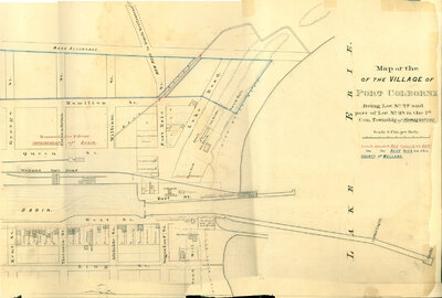
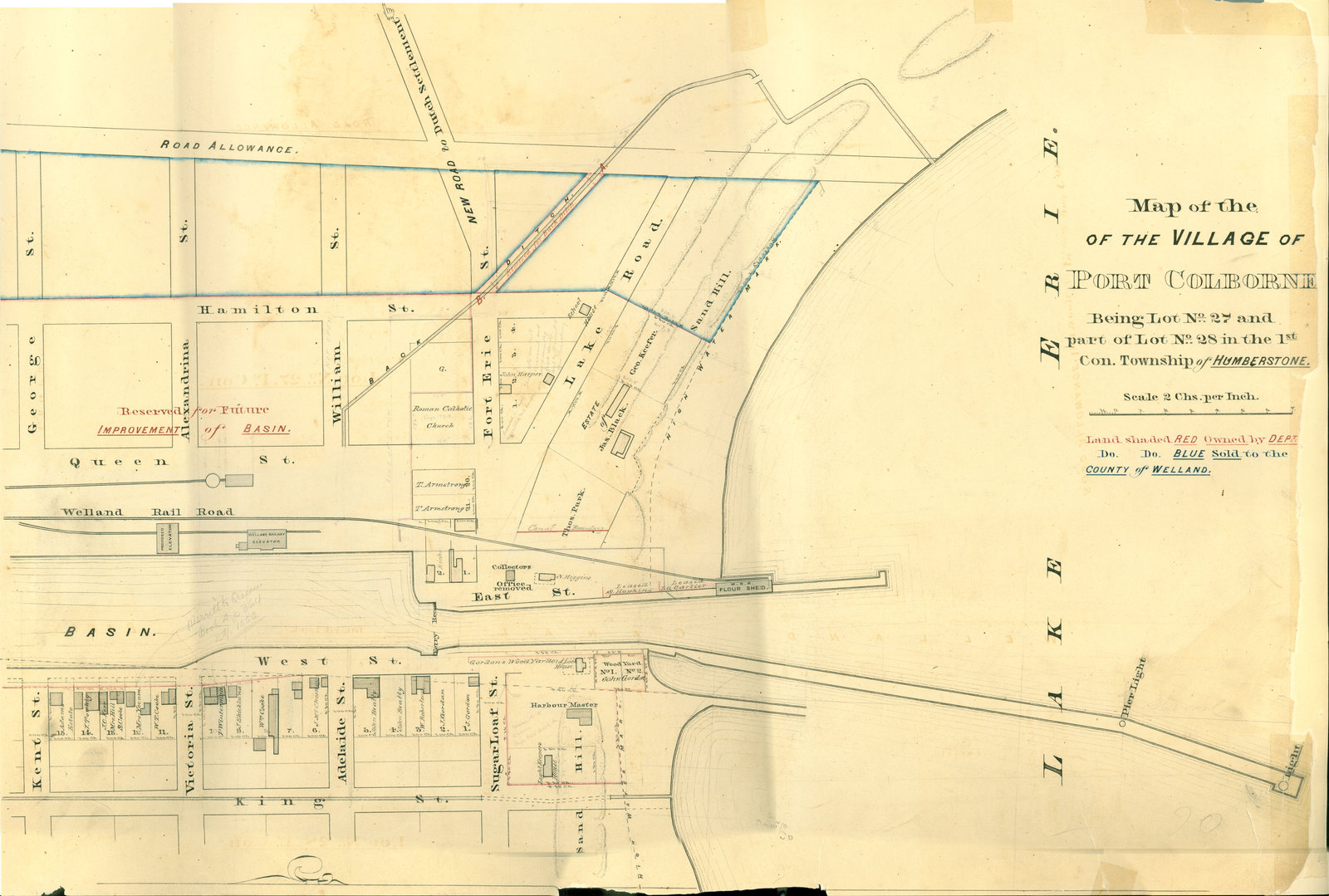
Village of Port Colborne survey map, c. 1855
Item
Title
Village of Port Colborne survey map, c. 1855
Description
Survey map of the Second Welland Canal created by the Welland Canal Company showing the areas in and around Port Colborne. Identified structures associated with the Canal include Lighthouse, Pier Light, Old Lock House, Collector's Office, Harbour Master's House, Canal Boundary, Back Ditch, Reserved Back Ditch, Basin, Light-Keeper's House and Ferry Recess. The surveyors' measurements and notes can be seen in red and black ink and pencil. Local area landmarks and businesses are also identified and include Gordon's Woodyard, Welland Rail Road, Welland Railway Elevator and Proposed Elevator, W.R.R. Flour Shed, Roman Catholic Church, School House, Sandhills, Lake Erie, and the High Water Mark.
Creator
Welland Canal Company
Date
c. 1855
Subject
Welland Canal
Port Colborne (Ont.)
Port Colborne (Ont.)
Source
Welland Canal/St. Lawrence Seaway Authority fonds, RG 422, Archives and Special Collections, Brock University.