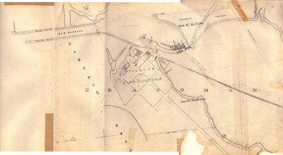
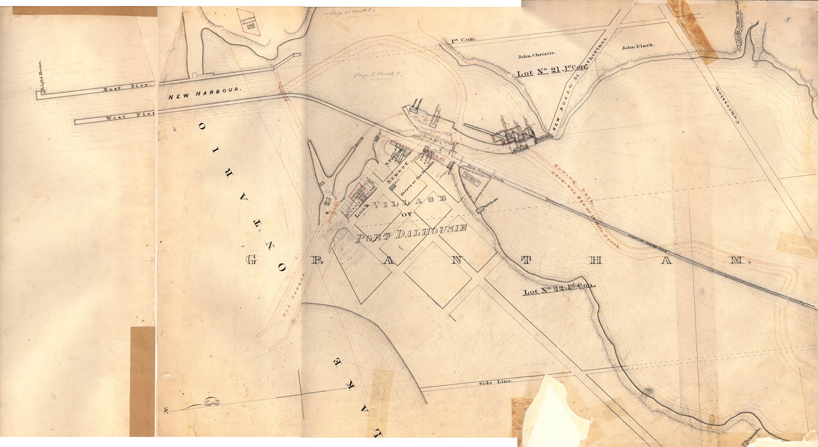
Second Welland Canal, Lock 1 and Port Dalhousie, c. 1855
Item
Title
Second Welland Canal, Lock 1 and Port Dalhousie, c. 1855
Description
Survey map of the Second Welland Canal created by the Welland Canal Company showing the areas in and around Port Dalhousie and Grantham Township. Identified structures associated with the Canal include Lock 1, Lighthouse, Lighthouse Keeper's House, East and West Piers, Harbour, Waste Weir, Store House, Collector's Office, Collector Assistant Office, Lock Tender's House and the new towing path.
Features of the First Welland Canal are noted in red ink and includes the old Harbour, old Lock 1, old towing path and the original bed of the Twelve Mile Creek.
Features of the First Welland Canal are noted in red ink and includes the old Harbour, old Lock 1, old towing path and the original bed of the Twelve Mile Creek.
Creator
Welland Canal Company
Date
c. 1855
Subject
Welland Canal
Port Dalhousie (Ont.)
Port Dalhousie (Ont.)
Source
Welland Canal/St. Lawrence Seaway Authority fonds, RG 422, Archives and Special Collections, Brock University.