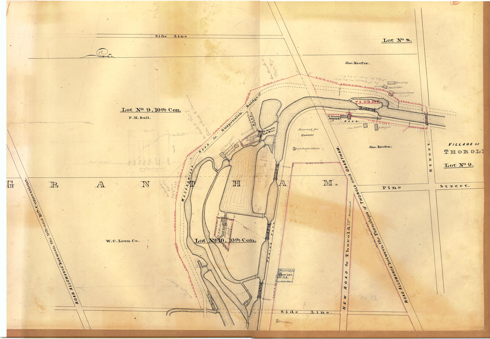
Second Welland Canal showing south Merritton
Item
Title
Second Welland Canal showing south Merritton
Description
Survey map of the Second Welland Canal created by the Welland Canal Company showing south Merritton along the boundary between the Grantham and Thorold Townships. Identified structures associated with the Canal include Locks 19, 20, 21, and 22, Lock Tenders House, and the towing path.
Creator
Welland Canal Company
Date
ca. 1855
Subject
Welland Canal
Merritton (Ont.)
Merritton (Ont.)
Source
Welland Canal/St. Lawrence Seaway Authority fonds, RG 422, Archives and Special Collections, Brock University.
