Map of the old and new Welland canal, 1914
Item
Title
Map of the old and new Welland canal, 1914
Description
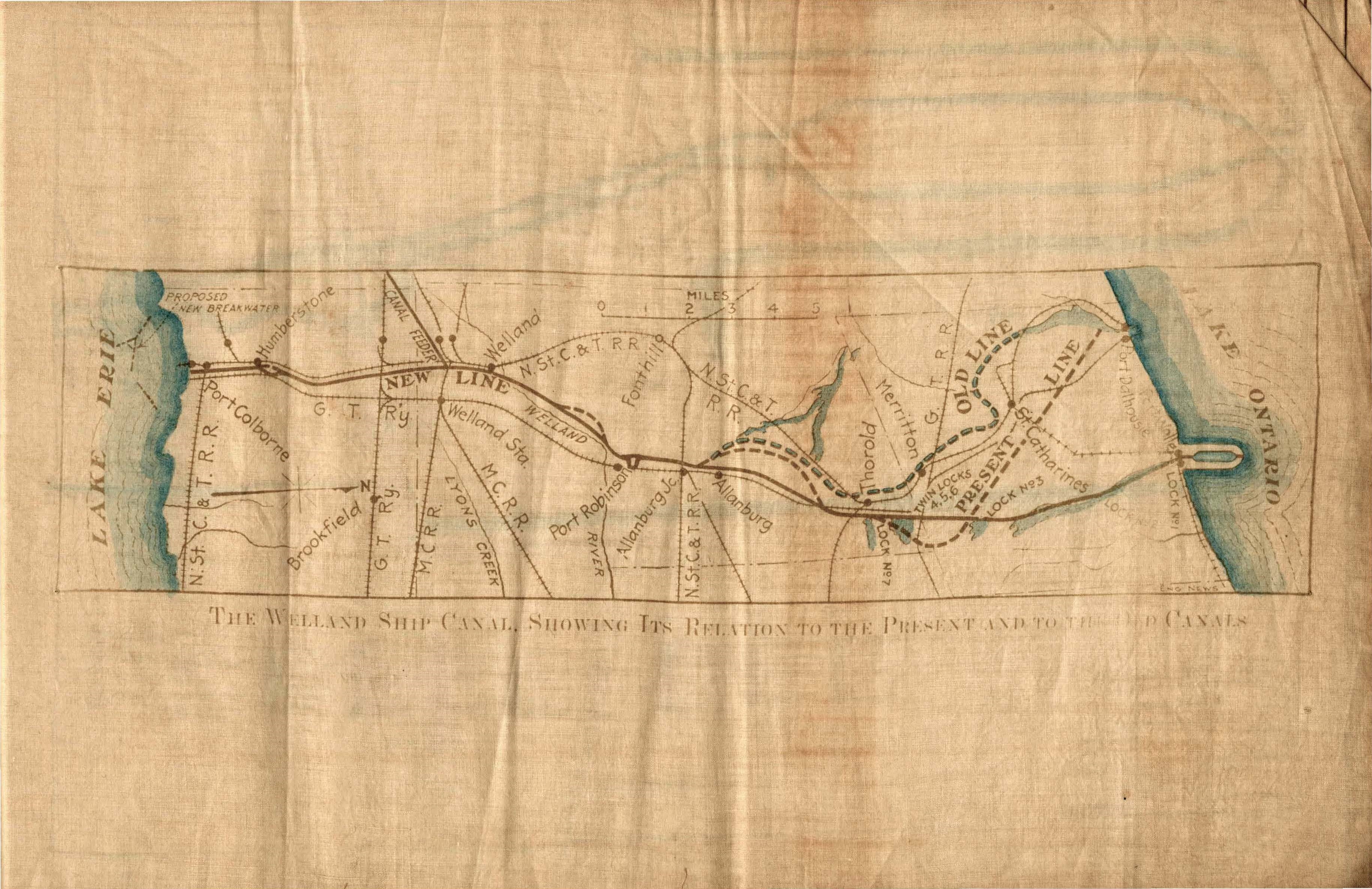
A map showing the Welland canal in relation to the present and old canals from a programme that details the visit/inspection of His Royal Highness, the Duke of Connaught and Her Royal Highness, the Princess Patricia on May 11, 1914. Sections 1, 2, 3 and 5 are described as the stopping points along the canal during the visit. The second portion of the programmme discusses the history of the canal (canals 1 through 4) and includes maps and diagrams. The diagrams include: "The Welland Ship Canal Showing its Relation to the Present and to the Old Canals", Section No. 1 General Plan, Section showing material underlying West Embankment of Lock No. 2 Pond, Section No. 2 General Plan, and Section No. 3 General Plan.
Creator
Welland Canal Ship Company
Date
1914-05-11
Subject
Welland Canal
Source
Richard Edward (Ted) Yates fonds, RG 649, Archives and Special Collections, Brock University.