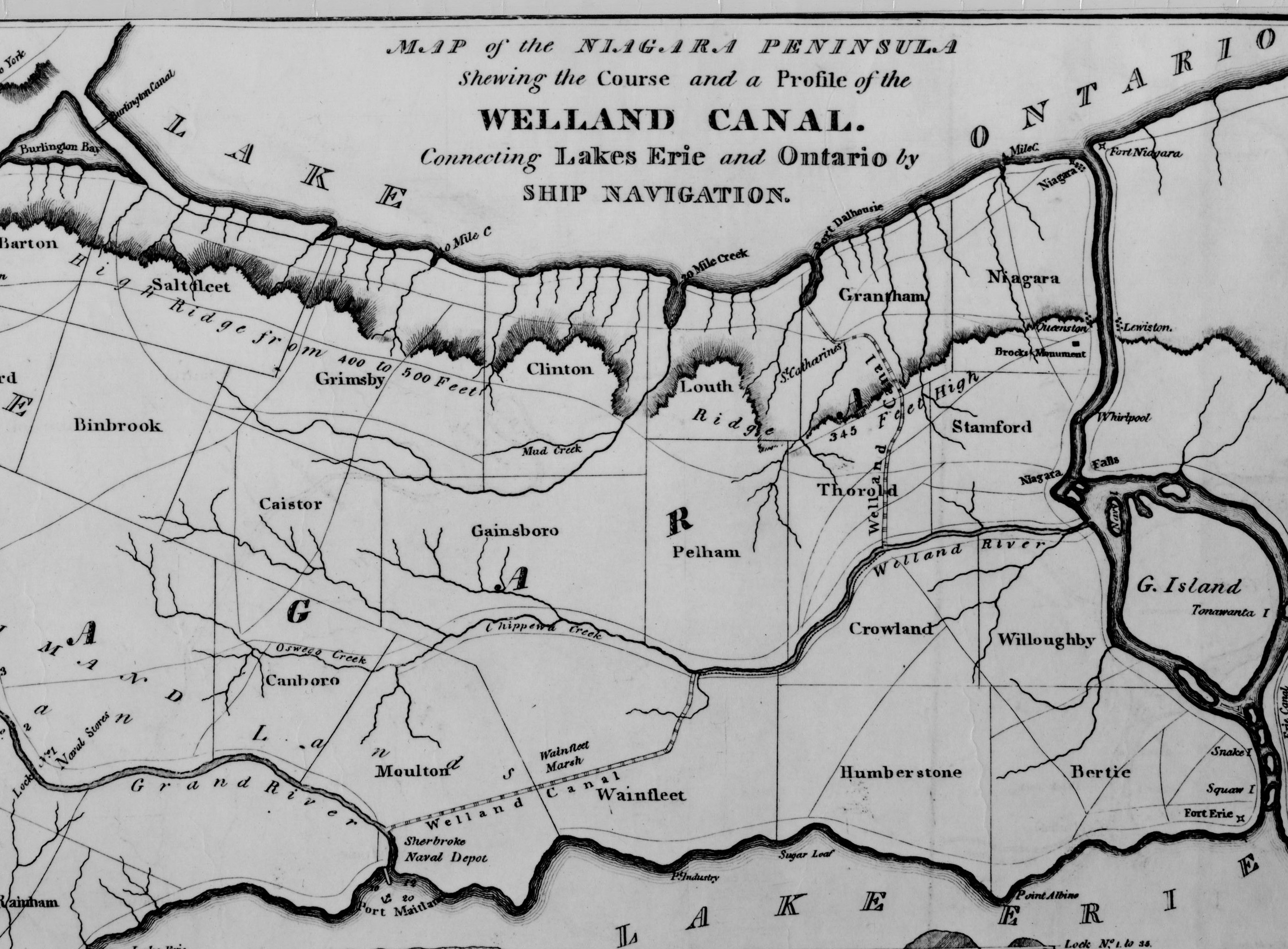
Map of the first Welland Canal, 1828
Item
Title
Map of the first Welland Canal, 1828
Description
Map showing the route of the First Welland Canal before completion of feeder and route to Port Colborne, township boundaries, main towns, forts, escarpment, rivers, creeks and major roads. Includes profile cross-section from Lake Erie to Lake Ontario
Creator
Keefer, George
Doolittle, A.
Doolittle, A.
Date
1828
Subject
Welland Canal
Source
First Welland Canal, 1828, Historical Maps of Niagara, Map Library, Brock University.