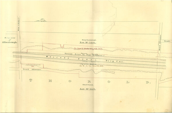
Deep Cut in Thorold with the Village of Allanburg
Item

Title
Deep Cut in Thorold with the Village of Allanburg
Description
Survey map of the Second Welland Canal created by the Welland Canal Company showing the canal in the Thorold Township just south of Allanburgh. Identified structures and features associated with the Canal include the Deep Cut and the towing path. The surveyors' measurements and notes can be seen in red and black ink and pencil. Local area landmarks are also identified and include streets and roads (ex. Road to Port Robinson), and the Spoil Bank. Properties and property owners of note are: Lots 142 and 143, John J. Church, Henry Vanderburgh, and Martin Delamatter and G. Coulter.
Creator
Welland Canal Company
Subject
Welland Canal
Allanburg (Ont.)
Allanburg (Ont.)
Source
Welland Canal/St. Lawrence Seaway Authority fonds, RG 422, Brock University Archives.