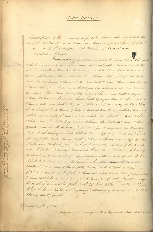
Description of John Hainer's land by the Welland Canal - 1826
Item
Title
Description of John Hainer's land by the Welland Canal - 1826
Creator
Board of Works - Welland Canal Company
Date
1826
Description
Survey description of John Hanier's land created by The Welland Canal Company. Included is a written description of the land. The drawing for the land can be found in William Hamilton Merritt's record and their land bordered one another.
Noteable features include; line between Gould's and Hanier's land, line between Hanier's and Merritt's land, road, Hayward Distillery, draw bridge.
Surveyor notes are seen in pencil on the map.
The survey was signed and submitted on August 23rd, 1826. The survey was updated August 26th, 1831.
The land is 18 acres, 2 roads and 27 perches.
Format
Width: 28 cm
Height: 43 cm
Height: 43 cm
Language
English
Place
St. Catharines, Ontario, Canada
Publisher
Welland Canal Company
Contributor
Original maps are held by the Brock University Archives & Special Collection. This item has been reproduced with permission.
Relation
St. Lawrence Seaway Authority (Canada) Fonds - RG 422, Brock University Archives
Rights Holder
© St. Lawrence Seaway Authority (Canada). © Transport Canada.
Subject
Welland Canal
Surveys
Surveyors
Rivers
Roads
Land

