Welland Canal Survey Map, Book 1, Map 11 - St. Catharines, c.1855
Item
Title
Welland Canal Survey Map, Book 1, Map 11 - St. Catharines, c.1855
Creator
Board of Works - Welland Canal Company
Date
c.1855
Description
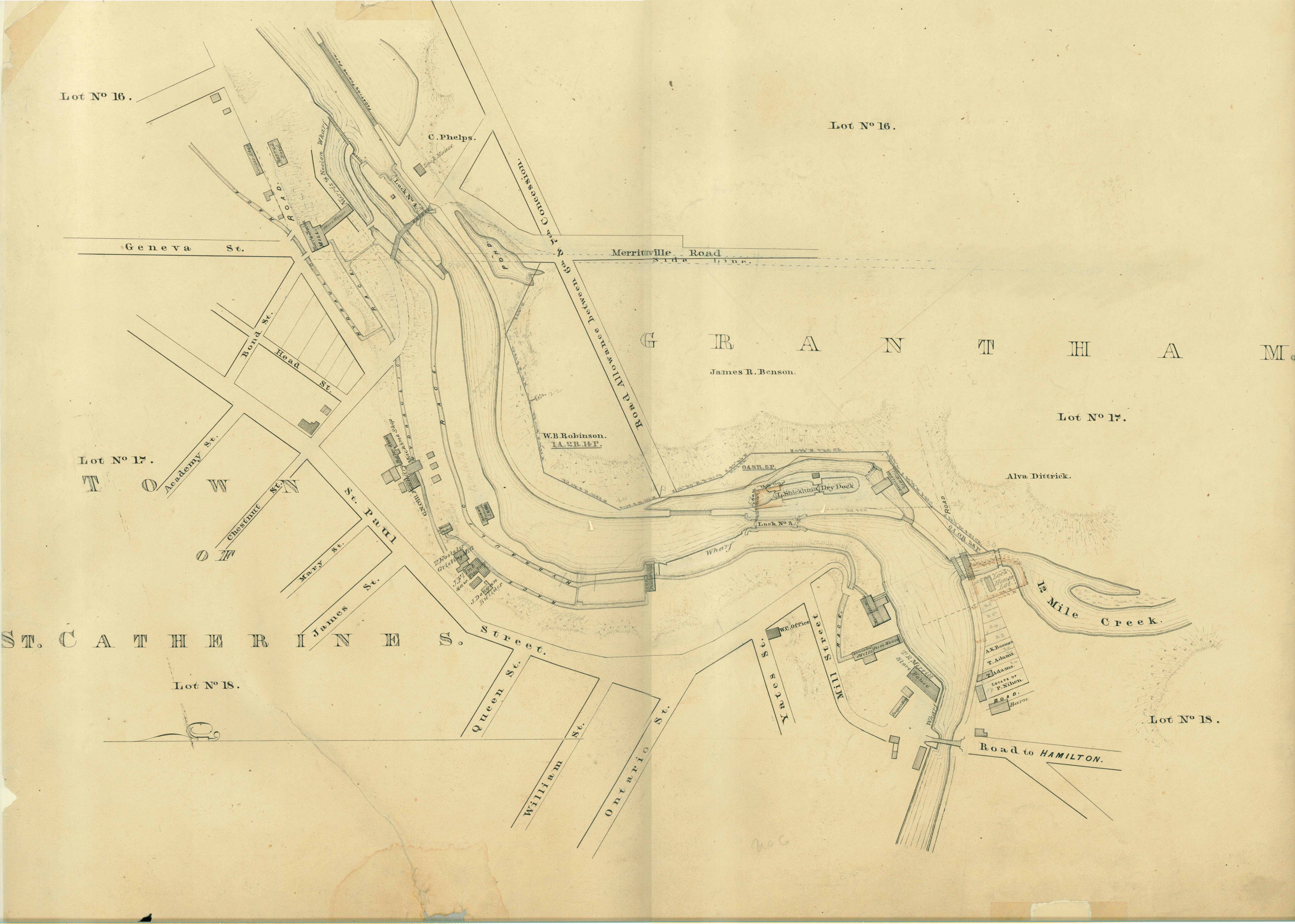
Survey map of the Second Welland Canal created by the Welland Canal Company showing the Town of St. Catharines. Identified structures associated with the Canal include Lock 3 and its Lock House, Lock 4 and its Lock House, Hydraulic Race, and a floating tow path.
The surveyors' measurements and notes can be seen in red and black ink and pencil.
Local area landmarks are also identified and include streets and roads (ex. Geneva Street, Ontario Street, St. Paul Street, and Merritville Road), Lincoln Mills and its Store House, T. M. Merritt's Store House, Cooper Shop, Louis Shickluna's Dry Dock, Peter McGill's Grist Mill, J. Flint's Saw Factory, T. Hosteter's Gristing Mill, J. Dougan Builder's shop or office, Norris & Nelson Mill, G. N. Oil Foundry and its Machine Shop and Boiler, a barrel shed, woolen factory, Estate of P. Nihen (or T. Nihan), Norris & Nelson's Wharf, the W. C. Office, and structures (possibly houses) or small properties belonging to T. Adams, and A. K. Boomer.
Properties and property owners of note are: Concession 6 Lots 16, 17, and 18, Concession 7 Lots 16, 17, and 18, Alva Dittrick, James R. Benson, W. B. Robinson, and C. Phelps.
Format
Width: 100 cm
Height: 45 cm
Height: 45 cm
Language
English
Place
St. Catharines, Ontario
Contributor
Original maps are held by the Brock University Archives & Special Collection. This map has been reproduced with permission.
Relation
St. Lawrence Seaway Authority (Canada) Fonds - RG 422, Brock University Archives
Rights Holder
© St. Lawrence Seaway Authority (Canada). © Transport Canada.
Subject
Welland Canal
Rivers
Bridges
Docks
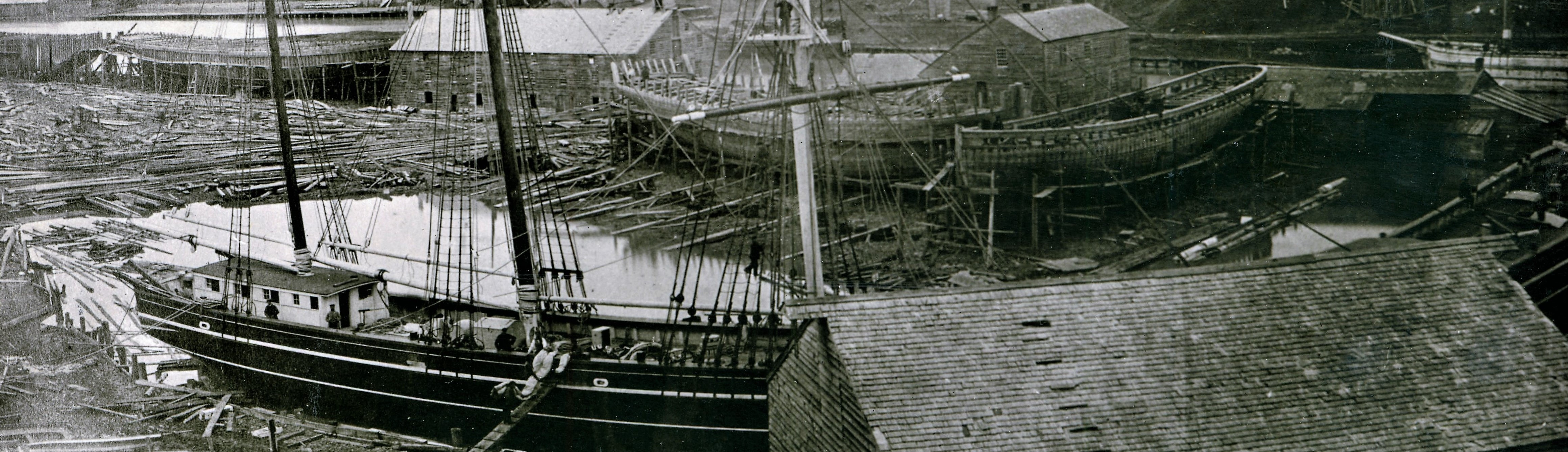
Shipbuilding
Shipyards
Surveys
Surveyors