-
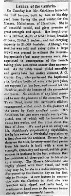
A full description of the launch of the ship "Cambria" from the 24 April 1862 issue of the St. Catharines Constitutional newspaper. The ship was built by Louis Shickluna and the article stated the following about his craftsmanship:
“We need pass no eulogy on Mr. Shickluna’s ship building capabilities, for he has earned a Provincial reputation as a first class marine architect. No man better deserves the title, for every vessel that passes from his hands is built with a view to strength, symmetry and speed, and his great success in business is the best evidence that he combines all three qualities in his ships to a nicety.”
-
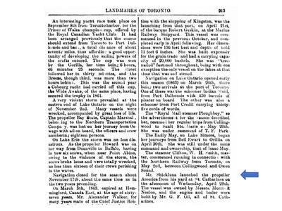
Pages from the book "Landmarks of Toronto" with mention of ships launched from the Shickluna Shipyard.
-
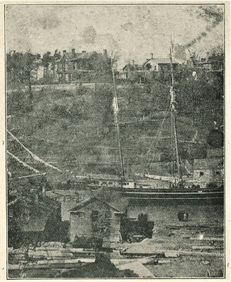
View of the Shickluna shipyard with a sailing vessel present. At the top of the photo is "Oakhill" the residence of William Hamilton Merritt.
-
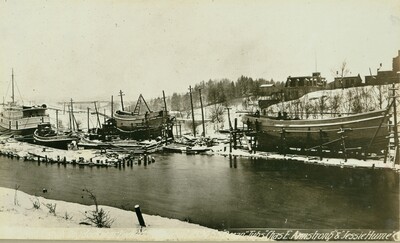
A view of the dry dock at Lock 3 in 1894 showing the steamship Ocean and the tugs Chas. E. Armstrong and Jessie Hume. The Shickluna family sold this dry dock earlier in 1892.
-
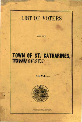
The 1874 voters list for the Town of St. Catharines.
It includes the name of the voter, residence status (owner / tenant / occupant), and street where individuals lived. The male members of the Shickluna family are listed as follows:
St. Thomas' Ward - Page 7 - Henry, Lewis, George and Joseph
St. George's Ward - Page 15 - Louis
Note: two Louis Shicklunas are listed at two different residences with two different spellings - Lewis and Louis. Both were known spellings of the master shipbuilder.
-
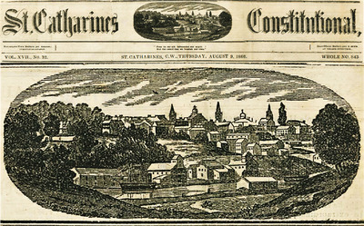
The nameplate of the St. Catharines Constitutional Newspaper included a representative image of the city looking across the Twelve Mile Creek towards the downtown area around 1866. To the bottom left shows what would be a building of the Shickluna Shipyard.
-
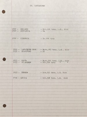
Marine historian, Ivan S. Brookes, kept notes on a various of maritime topics including shipbuilders of the major cities in Ontario including St. Catharines. This list shows some of the ships that were built in St. Catharines that Mr. Brooks discovered during his research. 'L.S." in his notes refers to Louis Shickluna.
The listing includes the following ships by Shickluna: Welland (1847), Lafayette Cook (1851), Malta (1853), St. Andrew (1853), Teresa (1855), Louisa (1856).
-
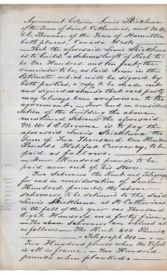
A drafted agreement between Louis Shickluna and M. W. & E. Browne of Hamilton to build a 110 foot schooner in 1845. The cost of the ship was to be £2100 Halifax Currency. The terms of the agreement are laid out as well as the payment schedule which included the transfer of two older schooners to Shickluna.
-
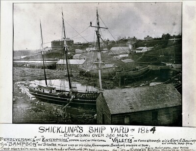
A photograph of the Shickluna Shipyard taken in 1864. Visible in the top photo are the "Perseverance" and "Enterprise" at the upper left and the "Valetta" in the foreground with Captain J. Sullivan on the upper yard arm. The tug "Sampson" is on stocks to the right end with Commodore Shickluna standing at the bow. At the time, the Shipyard was reported to employ over 300 men.
-
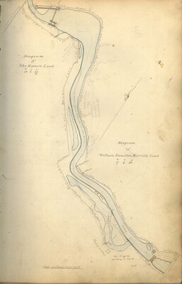
Survey map of John Hanier and William Hamilton Merritt's land created by The Welland Canal Company. This survey map is accompanied by written descriptions of the land.
Noteable features include; line between Gould's and Hanier's land, line between Hanier's and Merritt's land, road, Hayward Distillery, draw bridge, saw mill, salt works, line between Hainer's and Merritt's land,line between John Clendennan's and Merritt's land, road, tow path, 12 Mile Creek, and Welland Canal.
Surveyor notes are seen in pencil on the map.
The survey was signed and submitted on August 23rd, 1826. The survey was updated August 26th, 1831.
Hainer's land is 18 acres, 2 roads and 27 perches. Merritt's and is 17 acres, 3 roads and 20 perches.
-
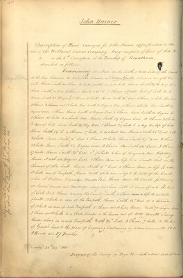
Survey description of John Hanier's land created by The Welland Canal Company. Included is a written description of the land. The drawing for the land can be found in William Hamilton Merritt's record and their land bordered one another.
Noteable features include; line between Gould's and Hanier's land, line between Hanier's and Merritt's land, road, Hayward Distillery, draw bridge.
Surveyor notes are seen in pencil on the map.
The survey was signed and submitted on August 23rd, 1826. The survey was updated August 26th, 1831.
The land is 18 acres, 2 roads and 27 perches.
-
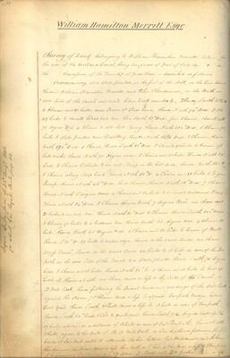
Survey description of William Hamilton Merritt's land created by The Welland Canal Company. Included is a written description of the land along with a drawing of the land. The drawing also includes John Hainer's Land.
Noteable features include; saw mill, salt works, line between Hainer's and Merritt's land,line between John Clendennan's and Merritt's land, road, bridge, tow path, 12 mile creek and canal.
Surveyor notes are seen in pencil on the map.
The survey was signed and submitted on August 23rd, 1826.
The land is 17 acres, 3 roads and 20 perches.
-
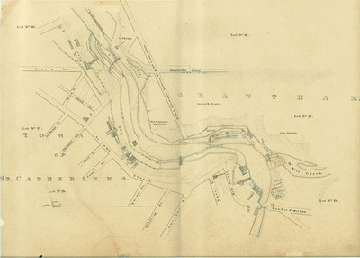
Survey map of the Second Welland Canal created by the Welland Canal Company showing the Town of St. Catharines. Identified structures associated with the Canal include Lock 3 and its Lock House, Lock 4 and its Lock House, Hydraulic Race, and a floating tow path.
The surveyors' measurements and notes can be seen in red and black ink and pencil.
Local area landmarks are also identified and include streets and roads (ex. Geneva Street, Ontario Street, St. Paul Street, and Merritville Road), Lincoln Mills and its Store House, T. M. Merritt's Store House, Cooper Shop, Louis Shickluna's Dry Dock, Peter McGill's Grist Mill, J. Flint's Saw Factory, T. Hosteter's Gristing Mill, J. Dougan Builder's shop or office, Norris & Nelson Mill, G. N. Oil Foundry and its Machine Shop and Boiler, a barrel shed, woolen factory, Estate of P. Nihen (or T. Nihan), Norris & Nelson's Wharf, the W. C. Office, and structures (possibly houses) or small properties belonging to T. Adams, and A. K. Boomer.
Properties and property owners of note are: Concession 6 Lots 16, 17, and 18, Concession 7 Lots 16, 17, and 18, Alva Dittrick, James R. Benson, W. B. Robinson, and C. Phelps.
-
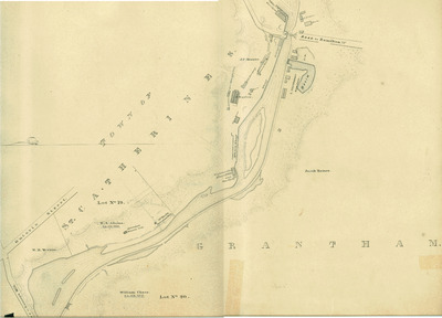
Survey map of the Second Welland Canal created by the Welland Canal Company along the western edge of the Town of St. Catharines. Although not labelled, the Second Welland Canal can be seen running through the map along with its tow path, which is located on the southwestern edge of the waterway.
The surveyors' measurements and notes can be seen in red and black ink and pencil.
Local area landmarks are identified and include streets and roads (ex. Ontario Street and Road to Hamilton), Artesian Mineral Well, Dr. Mack's Artesian Well, Stephenson House Mineral Well and Gas Works, New Brewery, Old Brewery, Welland House Mineral Well, Louis Shickluna's Shipyard, Vinegar Manufactory, Merritt's Covered Race, Mitchels Wharf, Sail Loft, an office, a tavern, two barns, a boathouse, a structure belonging to T. Nihan (or P. Nihen), and some store houses.
Properties and property owners of note are: Concession 6 Lot 20, William H. Merritt, E. S. Adams, William Chace, Jacob Hainer, J. Taylor, and J. P. Merritt.


