The First Welland Canal
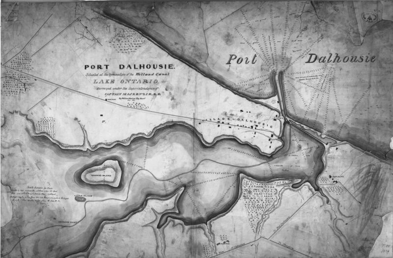
This is an early map of the whole of Port Dalhousie, from Martindale Pond, to the buildings of Port Dalhousie, and Village Dalhousie. "Surveyed under the superintendance of Captain Mackenzie, R.E. by William Hawkins Dy. Survr. Jany 1839". Bathymetric soundings illustrate the depth of Port Dalhousie. This is only a reproduction, as the original is at Archives Canada.