Introduction
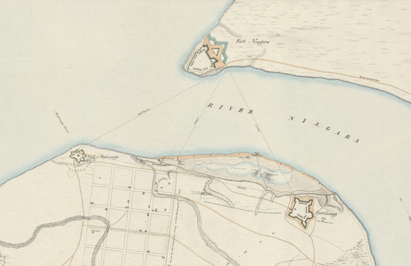
Plan of the Mouth of the Niagara River, showing the relative situations of Fort George, Mississauga, and Niagara, 1815.
During the War of 1812 many battles were fought on the Niagara frontier. Numerous forts spanned the border, from Niagara-on-the-Lake to Fort Erie, to aid in the defence of Canada and the United States. The Canadian shore featured four forts along this stretch of land. Throughout the two-year conflict, possession of these forts changed hands several times. Some were destroyed by the enemy who, after capturing the fort, later abandoned it and destroyed it so that it could not be used. Some of these forts were rebuilt, while others fell into disrepair and gradually disappeared. And a fort on the American shore was acquired by the British, only to be relinquished to the Americans when the peace treaty reinstated pre-war boundaries.
Most of the forts were concentrated at the mouth of the Niagara River at Lake Ontario. Fort Mississauga and Fort George were located in Niagara-on-the-Lake. Fort Niagara is located across the river on the American shore. Further down the river and above the Falls, Fort Chippawa was located where the Welland River meets the Niagara River. Fort Erie can be found at the mouth of the Niagara River at Lake Erie.