Fort Erie
Item
Title
Fort Erie
Description
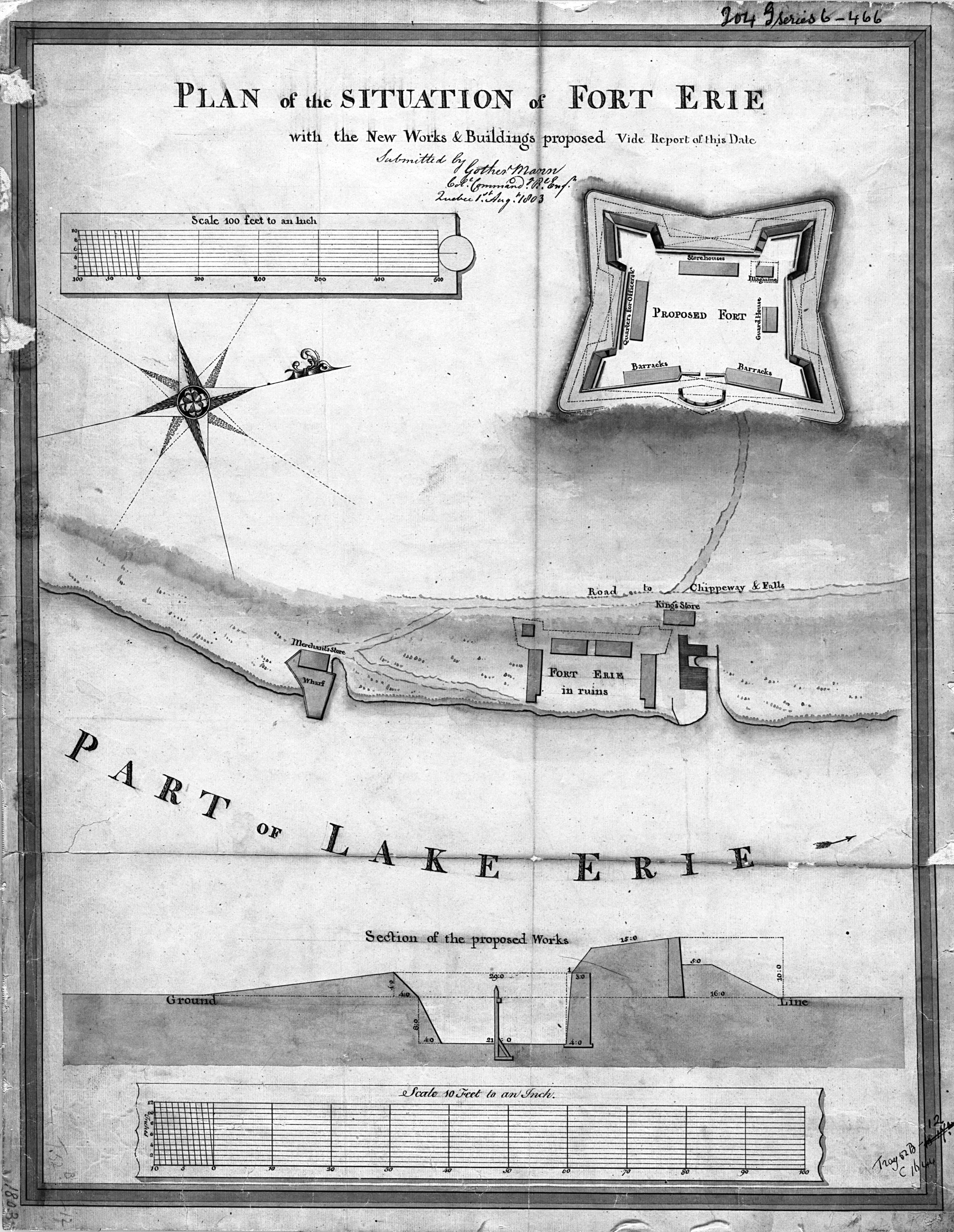
Historic plan showing the ruins of the original military Fort Erie and the plan for a new proposed fort. North is oriented to the right. Text beside the title reads: “Vide Report of this Date”. It is also signed by the author: “Submitted by Gother Mann Col. Command. Rl. Engr. Quebec 1st Aug’t. 1803.” Lake Erie is shown east of Fort Erie. Shown west of Lake Erie and East of the “Road to Chippeway & Falls” is the ruins of military Fort Erie, King’s Store, Merchant’s Store and a Wharf. An unlabeled roadway extends from the “Road to Chippeway & Falls” to the location of a proposed fort. Within the confines of the fort walls there are six buildings shown, which include: two barracks, quarters for officers, storehouses, magazine and a guard house. Inset at the bottom of the map is a section of the proposed works. Scales are provided for both the plan and the section. Relief is shown by shading.
Creator
Gother Mann
Date
1803
Subject
Fort Erie
Source
Digital reproduction: Library and Archives Canada, National Map Collection: NMC-3801. Original map size 19 1/2 x 14 1/2 cm. Georeferenced and modified by Map, Data and GIS Library, Brock University.