Plan of the Mouth of the Niagara River, shewing the relative Situations of Forts George, Missisaga, and Niagara
Item
Title
Plan of the Mouth of the Niagara River, shewing the relative Situations of Forts George, Missisaga, and Niagara
Description
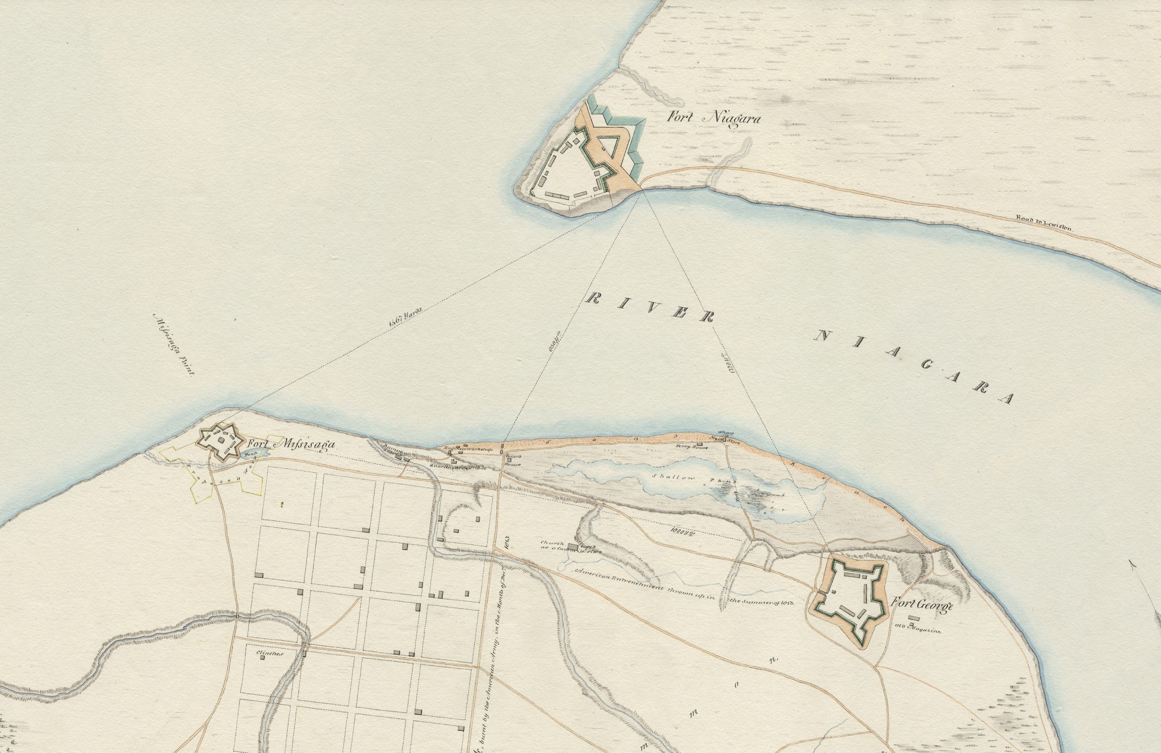
Historic map showing The Niagara River and both the American and British land on either side. Fort Niagara is shown at the very tip of the American side, where the Niagara River meets Lake Ontario. Also shown is a road labelled: “Road to Lewiston” which runs south, parallel the river from Fort Niagara. On the British side of the river the land is labelled “Town of Newark”, present day Niagara-on-the-Lake. Text accompanying the name of the town reads: “burnt by the American Army in the Month of Dec. 1813.” Fort Misisaga [sic] and Fort George are shown at the north side of Niagara. Directly beside the mouth of the Niagara River a small strip of land is labelled “Sand Beach.” In the centre of the beach is a wharf, the Reo Store and a ferry house. South of the ferry house is a shallow pond. South of the pond is a notation: “American Entrenchment thrown up in the Summer of 1813.” Multiple buildings are labelled on the map, most of which were for military purposes. Two waterways running from Lake Ontario through Niagara are labelled; One Mile Creek and Two Mile Creek. Further notations are made on various locations on the map indicating dates that buildings were destroyed by the American Army during the War of 1812.
Creator
B. Darley Cranfield, George Philpotts
Date
1815
Subject
Niagara River
Fort Niagara
Fort Mississauga
Fort George
Fort Niagara
Fort Mississauga
Fort George
Source
MDGL, Brock University, G 3464 N55 1815 C73