-
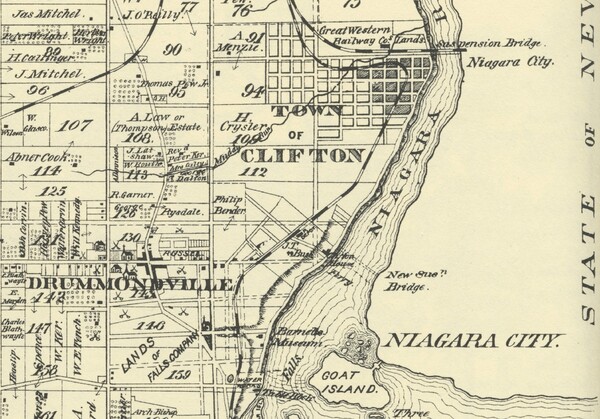
A map showing the Town of Clifton and some of the surrounding area. This section of the map is taken from a map of the Township of Stamford in the Illustrated historical atlas of the counties of Lincoln and Welland, Ont., Toronto : H.R. Page, 1876, p. 56.
-
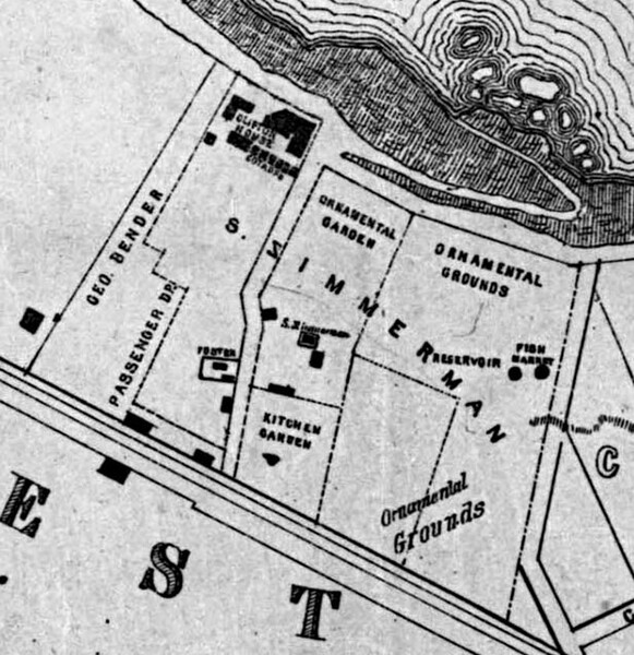
A map showing Samuel Zimmerman's property in Clifton and the City of the Falls, ca. 1854.
-
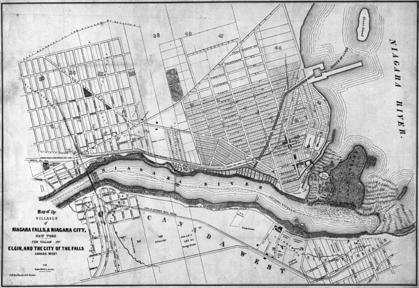
Historical map showing Niagara Falls, New York located to the east of the Niagara River and Canada West (now Ontario), to the west of the Niagara River. A dotted line runs through the centre of the Niagara River indicating the “National Boundary”. On the Canadian side of the river, the “City of the Falls”, current City of Niagara Falls, and Elgin are shown with main streets labelled as well as ownership of lots noted be last name. Streets and subdivisions are shown as well as. The Canadian and American Falls are labelled along with Goat Island and Bath Islands, which sit at the top of the falls in the river. The Erie and Ontario Rail Road is also indicated, running from the United States, over a bridge crossing the Niagara river and continuing north through Niagara Falls. Samuel Zimmerman's property is labelled.
-
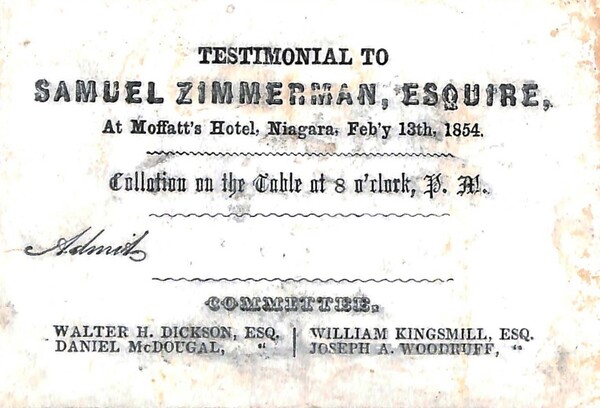
Notice of a testimonial to Samuel Zimmerman to be held at Moffatt’s Hotel, Niagara Falls on Feb. 13th 1854. Members of the committee were Walter H. Dickson, Daniel McDougal, William Kingsmill and Joseph A. Woodruff, 1854
-
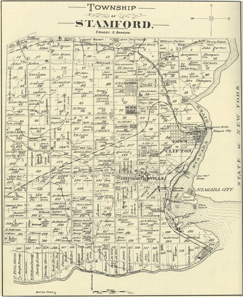
Map showing lot numbers with landowners' names, roads, railroads, battle fields identified with symbol. Digital reproduction of map on page 56 of Illustrated historical atlas of the counties of Lincoln and Welland, Ont., Toronto : H.R. Page, 1876. The map shows the Town of Clifton, Drummondville, and Stamford.
-

A lithograph of Samuel Zimmerman, 1857
-
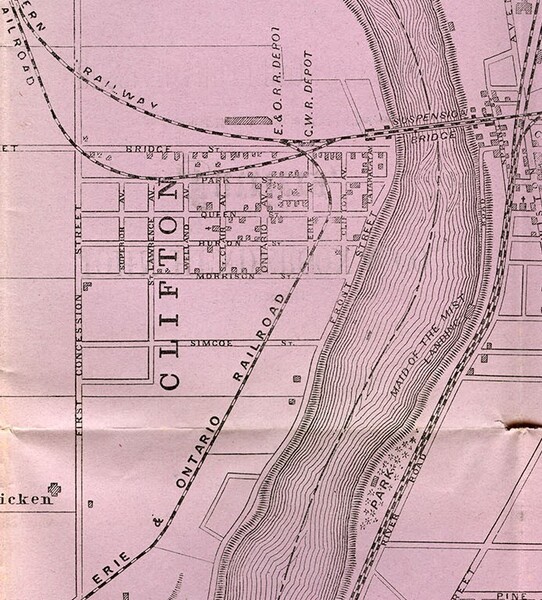
A map of the vicinity of Niagara Falls from "Tunis's topographical and pictorial guide to Niagara Falls". Detroit : W.E. Tunis, [1872], located in Brock University Archives and Special Collections call # SPCL F 127 N8 T9 1872. The map shows Clifton and the Great Western Railway and Erie and Ontario Railway lines and depots.
-

Indenture of release stating that all existing contracts and agreements made by the Woodstock and Lake Erie Railway Co. are cancelled. This release was between the executors of Samuel Zimmerman's will and the Woodstock and Lake Erie Railway Co. February 10, 1858.
-
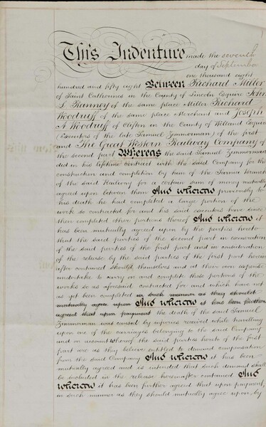
Indenture of release by executors between Richard Miller, John L. Ranney and Richard Woodruff, all of St. Catharines and Joseph A. Woodruff of Clifton, all executors of the will of Samuel Zimmerman of the first part and The Great Western Railway Company of the second part. Parties of the second part have exonerated parties of the first part to undertake and complete the Sarnia branch of the railway. Also, parties of the first part believe they are entitled to compensation as the death of Zimmerman was caused while travelling on one of the carriages belonging to said company. A sum of $150,000 was agreed upon to be paid to the executors by the Great Western Railway Company, September 7, 1858.
-
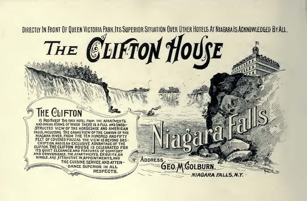
An advertisement for the Clifton House hotel in Niagara Falls, Ontario, from "The Falls of Niagara" by Knight, Leonard & Co. (Chicago).
-
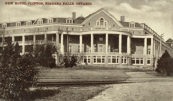
Postcard of the new Clifton Hotel, Niagara Falls, Ontario
-
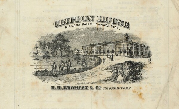
A drawing of the Clifton House from the cover of a Clifton House menu, September 25, 1865.
-
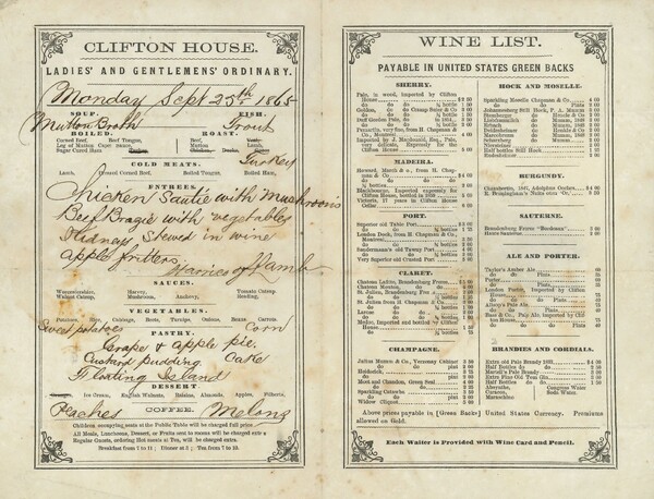
The menu, with wine list from the Ladies’ and Gentlemens’ Ordinary of the Clifton House hotel in Niagara Falls, Ont. Also includes handwritten additions or alterations to the printed menu. The proprietors of the hotel were D.H. Bromley & Co.
-
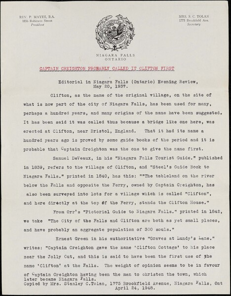
Editorial (1 typed page) which was printed in the Niagara Falls (Ontario) Evening Review on May 20, 1937, entitled “Captain Creighton Probably called it Clifton First”. This is printed on Lundy’s Lane Historical Society Letterhead by Mrs. Stanley Tolan. The article mentions “Samuel DeVeaux who created a “Niagara Falls Tourist Guide” which was published in 1839, April 24, 1948.


