
The Niagara Frontier - 1818 Map
Item
Title
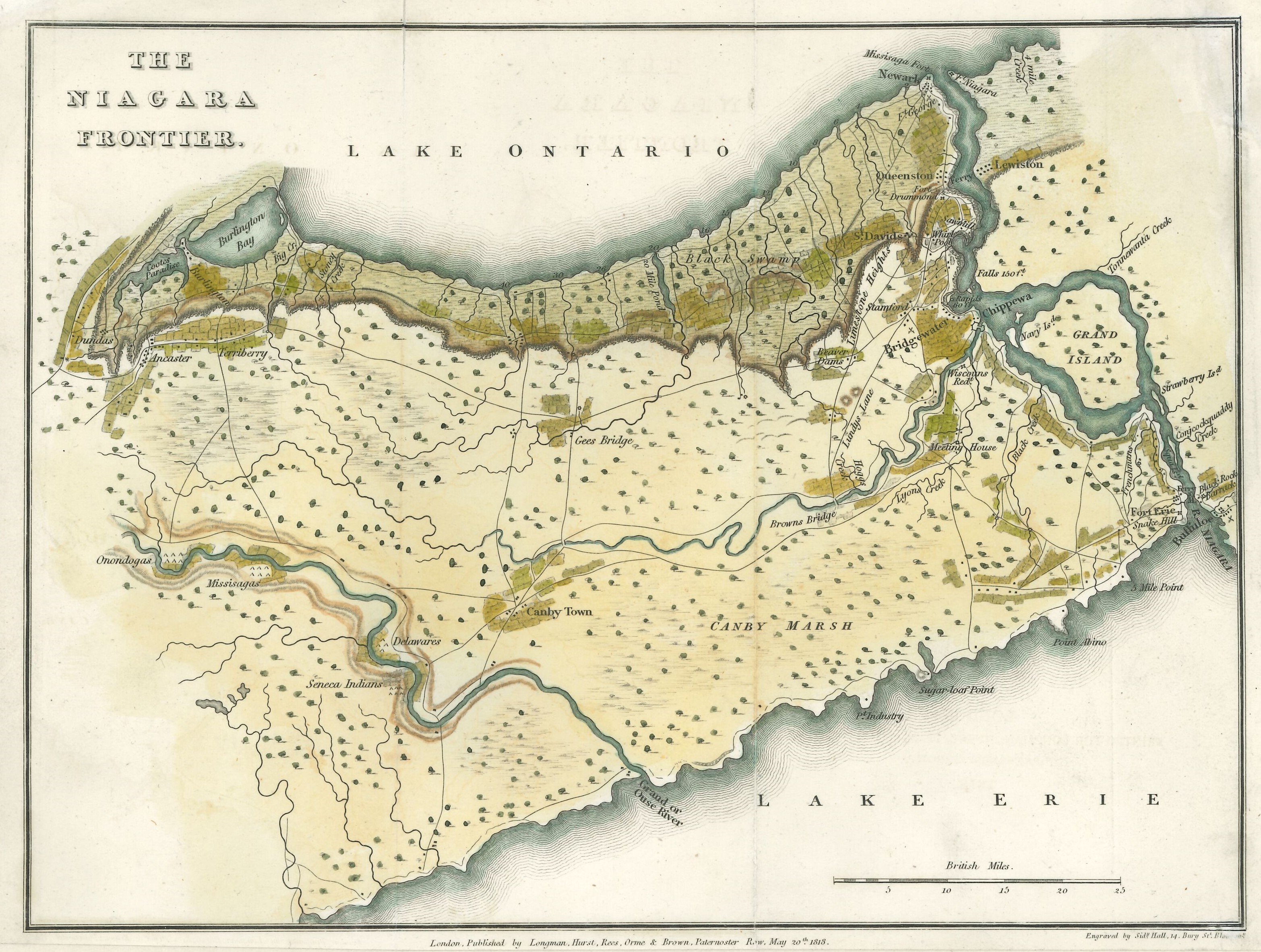
The Niagara Frontier - 1818 Map
Description
A map of the Niagara Frontier from "Travels in Canada and the United States in 1816 and 1817" by Lieutenant Francis Hall, 14th Light Dragoons, dated May 20, 1818. It depicts the Niagara Peninsula with communities, roads, creeks, and some topography features. The map was published by Longman, Hurst, Rees, Orme, & Brown and engraved by Sidney Hall. Colour has been added to some portions of the map.
list of authors
Sidney Hall
Francis Hall
Francis Hall
Publisher
Longman, Hurst, Rees, Orme, & Brown
Date Issued
1818
Source
RG 566, Map of the Niagara Frontier by Sidney Hall, 1818, Archives & Special Collections, Brock University Library.