The Welland Canal Project
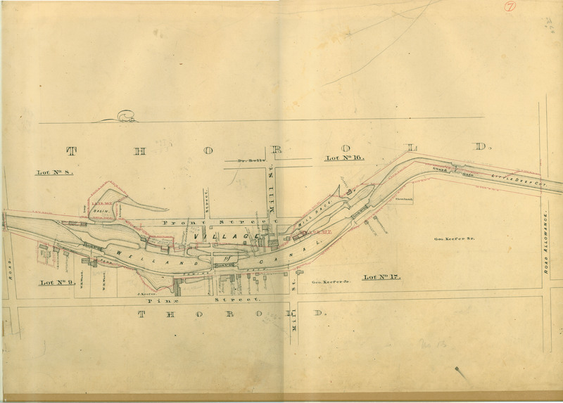
This is a Welland Canal survey map from c. 1855 showing the area of Thorold around Locks 23, 24 and 25. This was a working document that was always being changed with the times.
What is special is the level of detail that is included in this map. Not only does it highlight features of the Canal. But it also notes property owners, barns, mills, stores and taverns.
The rest of the maps which go from Port Dalhousie to Port Colborne can be found here- http://dr.library.brocku.ca/handle/10464/5045. And the originals can be found in the Brock University Archives.
Happy Archives Awareness Week!