
The Storytelling of Niagara
It is Archives Awareness Week. We wanted to share something very "Niagara".
Recently, the Map, Data & GIS Library and the Brock Archives teamed up to acquire a fun map that we had not seen before.
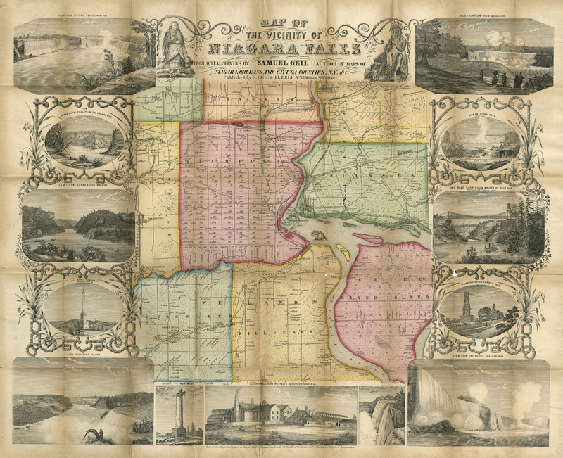
This is a great map entitled "The Vicinity of Niagara Falls" from c. 1853. The map is centered on Niagara Falls and extends to include both the Canadian and American sides of the river. Details include individual property owners and buildings, railroads, wagon roads, parts of the Welland Canal, and more.
The map is surrounded by thirteen vignettes of the region including four of the Falls in the corners of the sheet. It was published by Samuel Geil and J.L. Delp in Philadelphia.